当前位置:网站首页>Chapter 3: Use of GEE Data (3.1-3.3)
Chapter 3: Use of GEE Data (3.1-3.3)
2022-08-09 17:48:00 【Han Tianfang】
3. Use of GEE data
3.1 Introduction
Google Earth Engine is an innovative cloud computing platform for geospatial analysis.Its data types are very different from traditional data types handled by desktop software.In this chapter, we will introduce the basic Earth Engine data types for storing vector and raster data.Then, we'll explore the Earth Engine data catalog and how to interactively search Earth Engine datasets in the Jupyter environment.We will also cover how to obtain image metadata and compute descriptive statistics.Finally, we'll learn how to automatically convert Earth Engine JavaScript to Python.By the end of this chapter, you should have easy access to Earth Engine data using geomaps in the Jupyter environment.
3.2 Technical Requirements
To study this chapter, you will need to install geemap and several optional dependencies.If you've followed Chapter 1 - Introducing GEE and Geemap, you should already have a conda environment with the necessary packages installed.Otherwise, you need to create a new conda environment and install the pygis package using the following command, which will automatically install geemapand all necessary dependencies:
conda create -n gee pythonconda activate geeconda install -c conda-forge mambamamba install -c conda-forge pygis<边栏推荐
猜你喜欢


随机推荐
【建模必胜秘籍】往届国赛建模方法 2021高教社杯 国赛数学建模
Excel文件解析
低代码的开发前景
学编程的第十天
第四章:使用本地地理空间数据(4.1-4.5)
前言:关于作者吴秋生博士与此书简介
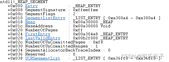
Heap series _0x04: Internal structure of heap (_HEAP=_HEAP_SEGMENT+_HEAP_ENTRY)
动态规划套题:零钱兑换、完全平方数
5. Visualizing Geospatial Data
标准IO及其各函数用法
MySQL数据库基本知识
学习编程的第二天
C语言冒泡排序法
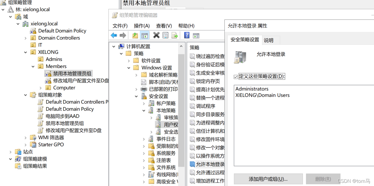
WinServer 2019 组策略删除本地管理员且只允许域用户登陆
fiddler的下载与安装
基于FTP协议的文件上传与下载
域控同步相关命令
while read line中执行ssh出现只执行一次
C语言扫雷
给我一个机会,帮你快速上手三子棋