当前位置:网站首页>Teach you how to get a 0.1-meter high-precision satellite map for free
Teach you how to get a 0.1-meter high-precision satellite map for free
2022-08-09 09:14:00 【3 d GIS technology community】
Downloading high-resolution national satellite imagery maps is easy.At present, there are many map softwares on the market that can be downloaded, but many software routines are too deep.
The following describes how to download ultra-high-definition satellite image maps for free, taking Chengdu as an example
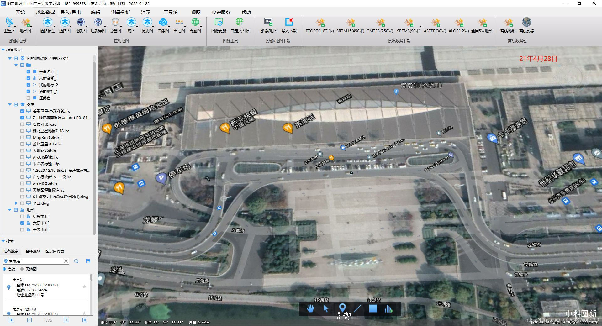
Tools: Tuxin Earth 4.0

1. Open Tuxin Earth and search for the area you want to download: Chengdu

2. Select the download data type: find Download - Image/Map, and the download area setting dialog box will pop up:


3. Download task configuration: Click [Select Surface] with the mouse, and then click the Chengdu map to pop up the download configuration interface:

Modify the configuration download parameters in the download task configuration:
① Output format: Currently supports tiles and TIF, just select TIF.
②Overlays and basemaps: Overlays are data superimposed on the basemap.For example, AutoNavi + Google Image, AutoNavi is the overlay, and Google Image is the bottom layer.Overlays or base layers can also be downloaded independently and used as overlays for other data.
③Download level: Drag to the gray square to adjust the level. The highest download level is 19, which is about 30 decimeters.
④Configuration complete:

4. Download and view: Click to start downloading, and a file location selection will pop up, which is to choose where to save the download results.Just choose a place, click OK to download, the whole download process is very smooth and simple.

Open the folder to select any level of map, double-click to open the tif file to view or drag the file to the new earth, gloabl Map professional map software for viewing without any offset.


-End-
边栏推荐
猜你喜欢


随机推荐
Redis基础
微信小程序获取用户收货地址列表wx.chooseAddress
ASP.net中的数据库应用
Flutter的基础知识之Dart语法
【环境搭建】onnx-tensorrt
convert转换时间详解
js实现看板全屏功能
SQL server中的数据类型
一篇文章带你熟悉 TCP/IP 协议(网络协议篇二)
政务中心导航定位系统,让高效率办事成为可能
谷歌地图时代结束,怎么看高清卫星影像地图?
教你如何免费获取0.1米高精度卫星地图
[Vulnerability reproduction] CVE-2018-12613 (remote file inclusion)
【培训课程专用】CA/TA调用模型-代码导读
运行flutter项目时遇到的问题
【场景化解决方案】构建设备通讯录,制造业设备上钉实现设备高效管理
AES/ECB/PKCS5Padding encryption and decryption
ARMv8/ARMv9视频课程-Trustzone/TEE/安全视频课程
gin中简单的curd接口例子
【场景化解决方案】OA审批与金智CRM数据同步